Battery Point is named after the three defence batteries that were built at various times on the point of land that is today’s park. They were statements of British territorial claim, a warning to foreign shipping and in the early days, a deterrent for convicts who hoped to steal an escape vessel. The batteries were also used for ceremonial purposes.
Mulgrave Battery was built in 1818 on the shoreline with an accompanying signal station. It was on the point of land known as ‘Blow My Skull Point’ after the explosive beverage once popular with the military officers who picnicked on this hill. Poorly positioned and all but useless, the fortification was described in 1829 by colonist Henry Widowson as:
[A] pitiful mud fort with half a dozen honeycombed guns perfectly harmless to the artillery men who fire them and serving only to make a noise on the King’s birthday and on one or two other public occasions.
– Old Hobart Town Today, Frank Bolt, page 141
To remedy this situation, a second Prince of Wales Battery was built in 1840, and a third, the Albert Battery, was constructed at the height of the Crimean War in 1854.
By 1880, as a result of technological and building developments, alternative batteries were constructed in Sandy Bay and Bellerive. In 1882, the site was handed over to the City of Hobart as a recreation ground. The magazine and parapets were retained for military purposes in case of war.
… a pitiful mud fort with half a dozen honeycombed guns perfectly harmless to the artillery men who fire them and serving only to make a noise on the King’s birthday…
Listen
Of the half-moon battery now in the progress of being constructed in the face of the hill near the flagstaff appears to our mind likely to prove of no use whatever, unless, indeed it is intended likewise to fortify the point abutting into the river by Sir John Pedder’s house.
For otherwise a vessel might anchor in perfect safety under this point, out of all possible danger from the guns of the battery, and by throwing a few shells put all the gunners to the rout.
We ask our readers to go and see the battery and then turn their eyes to the point we have directed; where vessels of considerable tonnage can float in perfect security from its guns, and this at a distance of a quarter of a mile from it.
– Hobart Town Courier, 28 May 1841
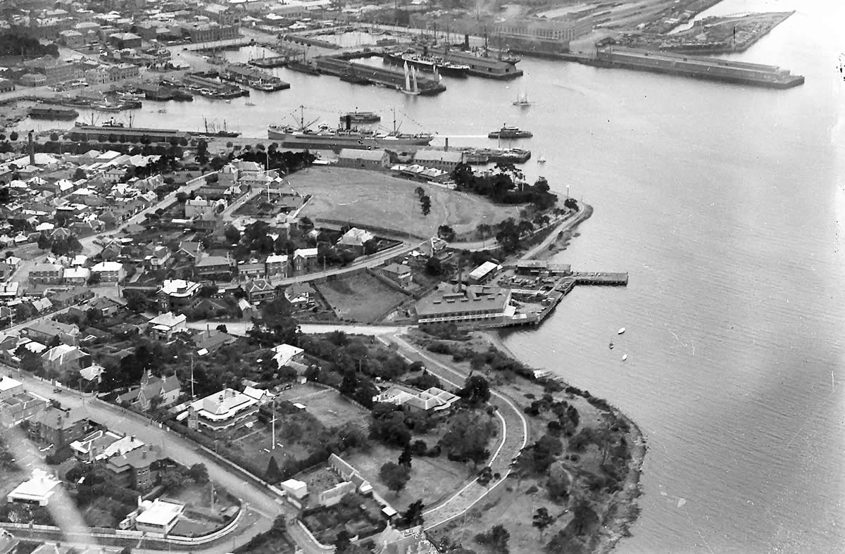
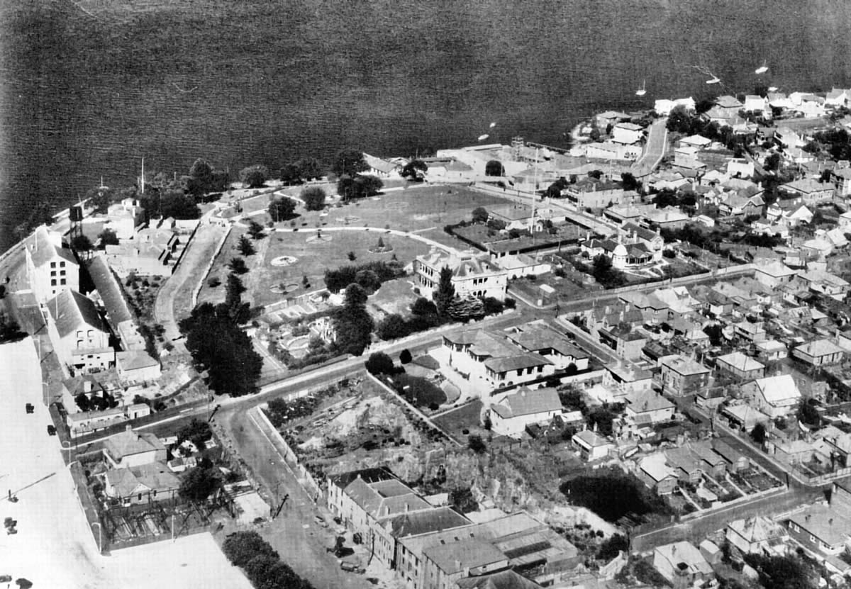
Regatta Day 1929
Princes Park in the centre of the photo is vacant ground. The Marine Board signal mast is on the crest of the hill. The shoreline in the foreground has now been reclaimed. Huon Cry fruit processing factory can be seen on the foreshore at the bottom right. Close scrutiny of this image of the park shows the remains of the earlier batteries on the site.
Source
Colin Dennison Collection
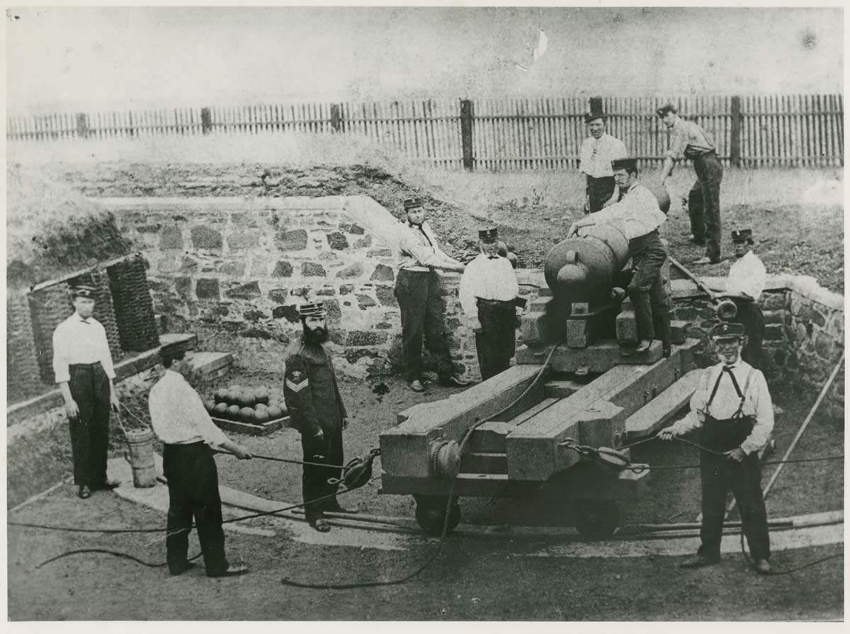
Typical gun crew used in Prince of Wales Battery
The Hobart Town Volunteer Artillery used the batteries to fire salutes and have shock and shell practice between 1858–1871. Beforehand, an officer visited each house behind the battery and asked the owner to open all windows. If this was not done, the windows shattered! (Note this photo is in the Queen’s Battery.)
Source
Tasmanian Museum and Art Gallery Q16008
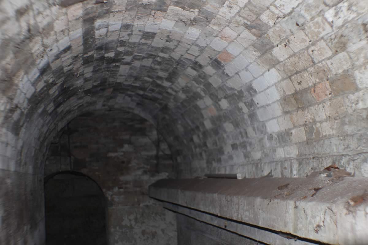
The magazine side passage below the battery 2015
It was designed to carry 144 barrels of powder or 200 rounds. It was solidly constructed on the traditional ‘room within a room’ model to absorb the shock of accidental blast.
Photo
Robert Vincent
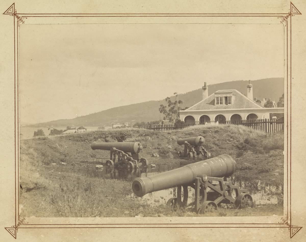
Albert Battery in disuse 1889
This battery at the top of a hill in Princes Park was virtually condemned from the start as it was too close to the surrounding buildings.
Source
Allport Library and Museum of Fine Arts, Tasmanian Archive and Heritage Office. AUTAS001126252014
Princes Park c1942
Princes Park was developed on the site of the three batteries. The signal masts established in 1818 can still be seen in this photo which was taken before any apartment blocks were built nearby.
Source
Colin Dennison Collection
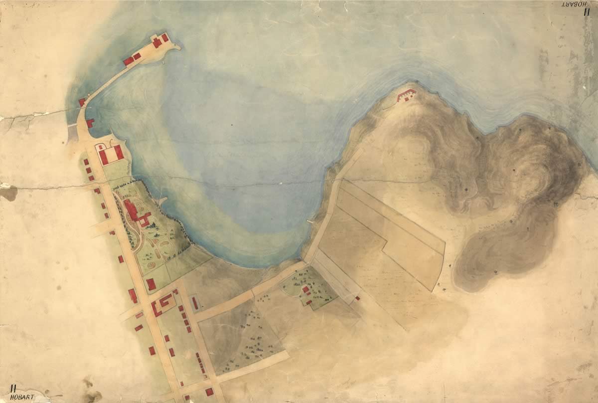
Princes Park Map – Hobart 11 – Sullivans Cove and part of Hobart Town 1827
Knopwood’s Cottage Green. In the centre top is the first Government House in what is now Franklin Square, Hunter Island causeway to the right top, contours and location of the military battery can be seen at the bottom right. This is now Princes Park.
Source
Tasmanian Archive and Heritage Office AF394 1 170 1827
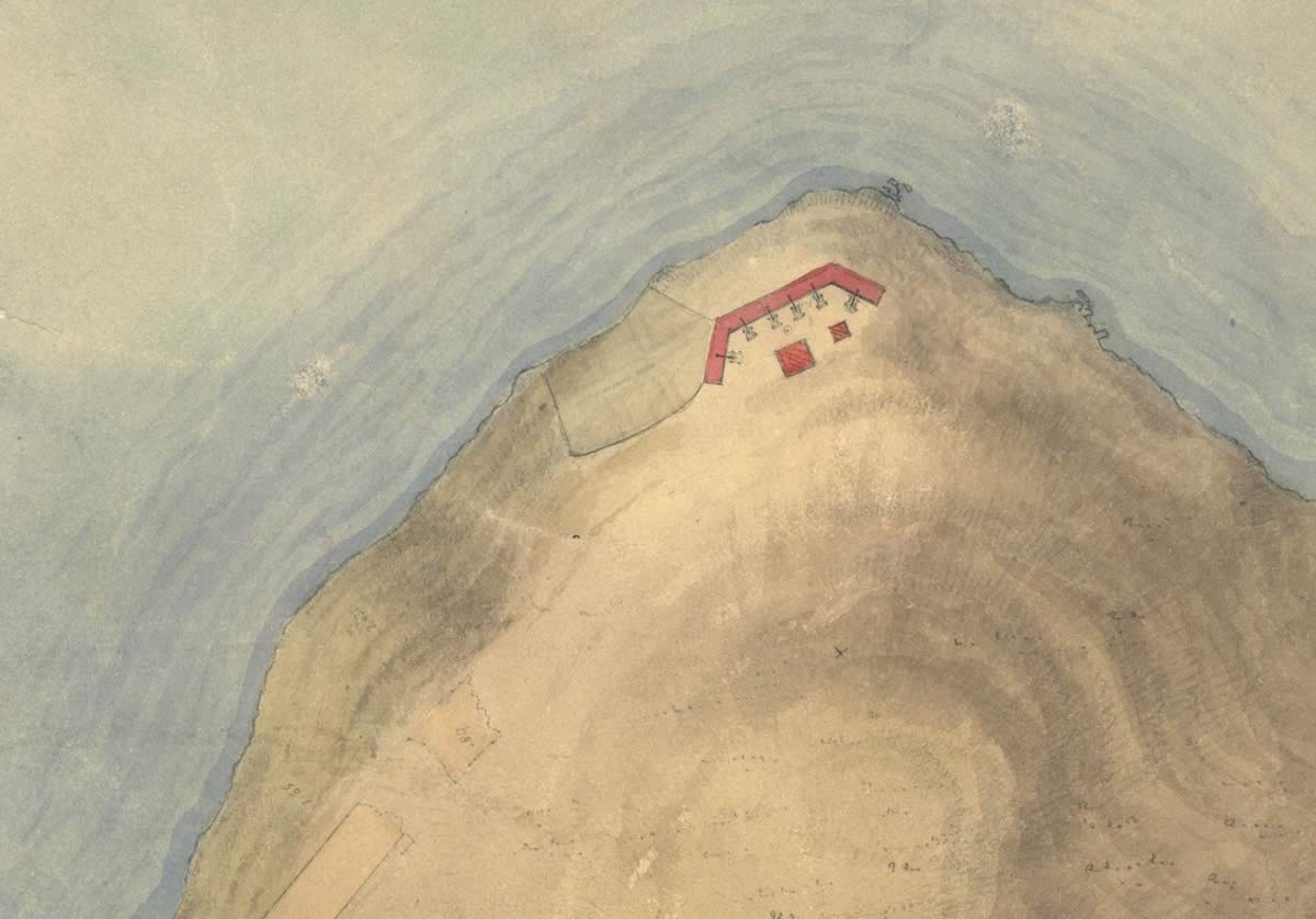
Mulgrave Battery, the first military battery in the colony 1827
Major Roger Kelsall notes that the southern point had a nickname of ‘Blow My Skull Point’ as a result of:
[A] mixture that was a good deal in vogue… with which … Government (officers) were occasionally in the habit of refreshing themselves at picnics given on this romantic hill.
Note the detail even showing the gun carriages and wheels.
Source
Tasmanian Archive and Heritage Office Detail from AF394 1 170 1827
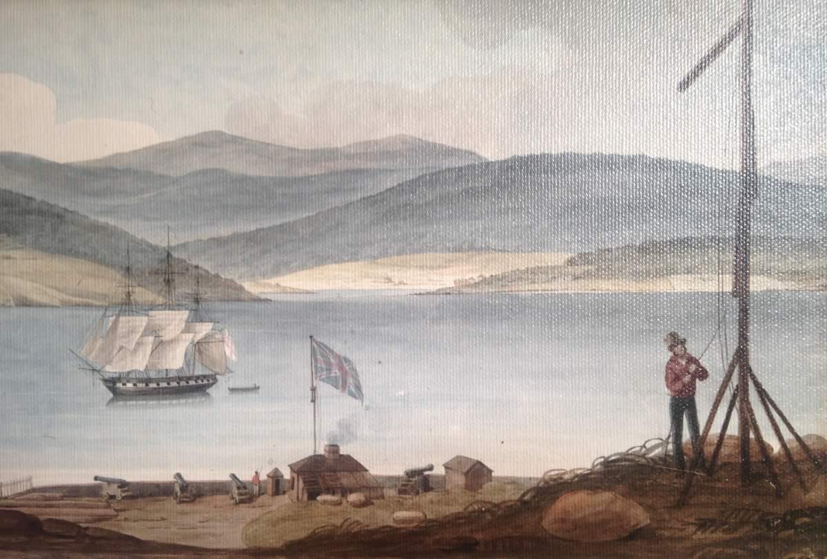
Mulgrave Battery 1827
The earliest use of Government land was for defence with the construction of the Mulgrave Battery in 1818. In 1829, this site became the centre for the semaphore–telegraph communication system of Van Dieman’s Land.
Source
Panel 5 of 6 from Panorama of Hobart by Augustas Earle c1827, Library of New South Wales
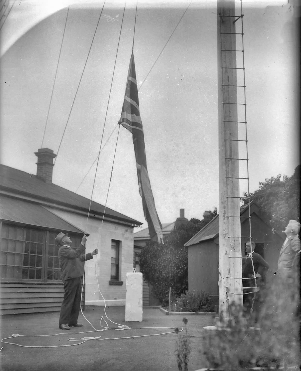
Signalman’s cottage at crest of the hill in Princes Park c1945
The flags on this mast denoted the origin of the vessels approaching Hobart. The vessel signalled in this photograph would have been British as this is the Union Jack. The cottage still exists in the top corner of the park.
Source
Colin Dennison Collection
Semaphore Cottage Princes Park c1942
An efficient signaling system operated between Port Arthur, various relay stations, the battery and the Mount Nelson signal station. It took less than 20 minutes to transmit a message to and from Port Arthur. The signaling system also reported vessels entering the Derwent estuary, including its country of origin and likely time of arrival. The semaphore mast is still in place at Mount Nelson.
Source
Tasmanian Museum and Art Gallery Q5569
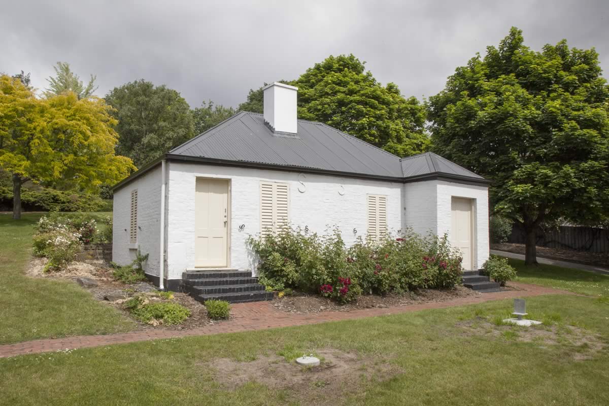
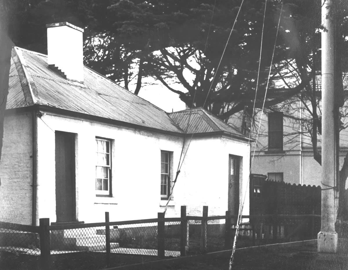
Semaphore Cottage 2015
Once part of the Mulgrave Battery complex, this cottage at the bottom of Princes Park is now the oldest remaining building on Battery Point.
Photo
Private collection
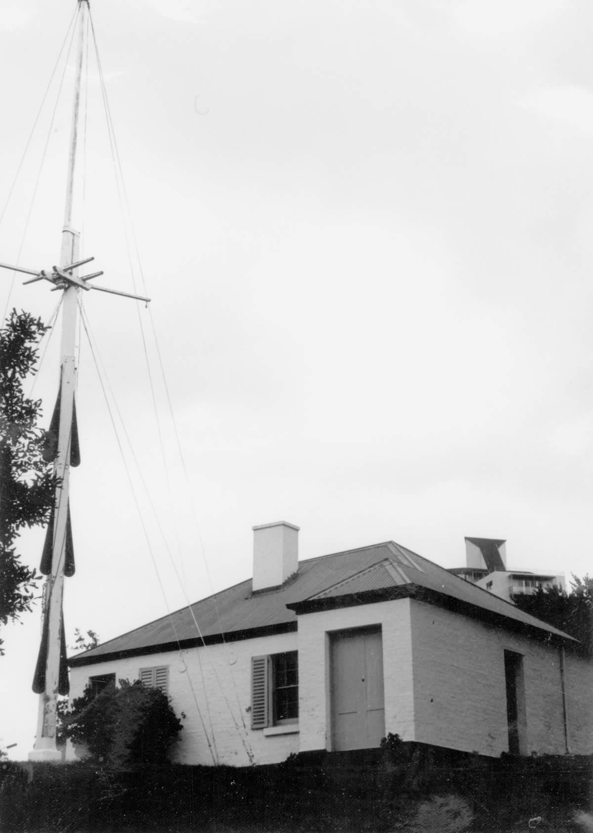
Semaphore mast
Note the signaling blades.
Source
Tasmanian Museum and Art Gallery Q17139.34
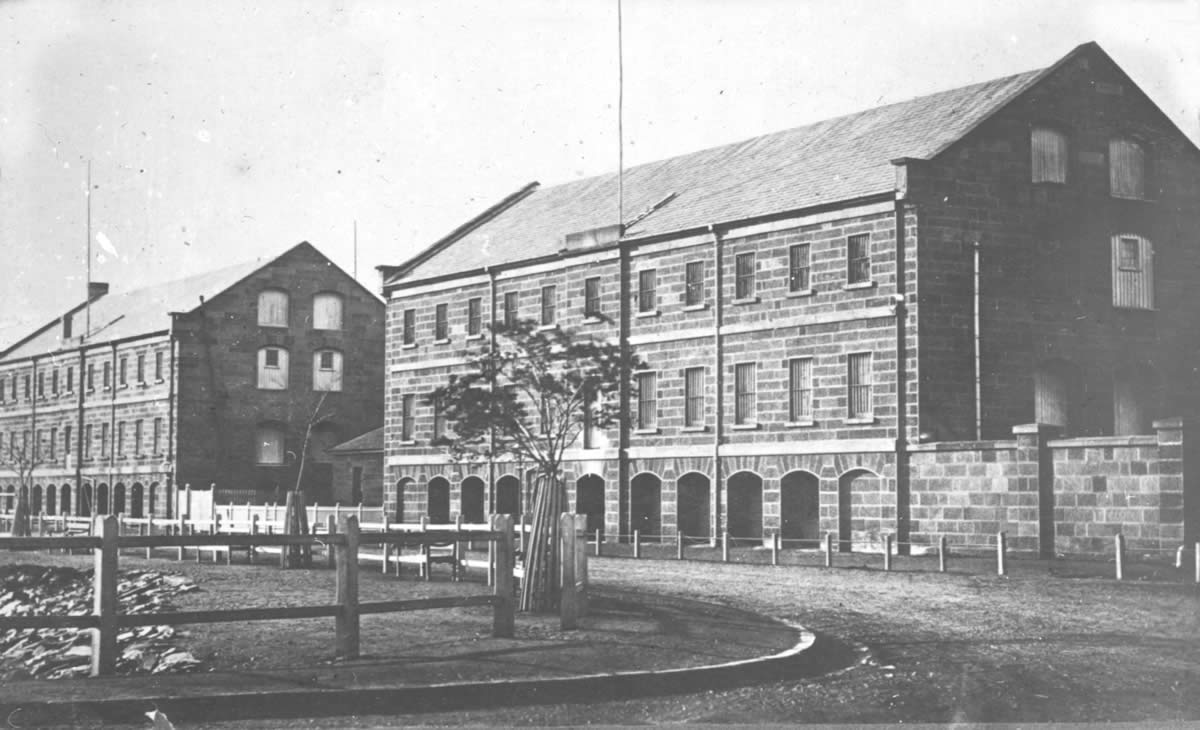
Ordnance Stores designed by John Lee Archer and built c1834
The Prince of Wales Battery gun carriages, barrels, ropes and pulleys were all kept in the basement of this building. The rest of the building was used for government stores.
Source
Tasmanian Museum and Art Gallery Q2001.15.9.11